


Capron Voting District, Southampton County, Virginia
About
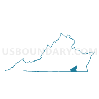
Outline

Summary
| Unique Area Identifier | 682556 |
| Name | Capron Voting District |
| County | Southampton County |
| State | Virginia |
| Area (square miles) | 62.22 |
| Land Area (square miles) | 61.98 |
| Water Area (square miles) | 0.24 |
| % of Land Area | 99.62 |
| % of Water Area | 0.38 |
| Latitude of the Internal Point | 36.69869930 |
| Longtitude of the Internal Point | -77.13064550 |
Maps


Graphs
Select a template below for downloading or customizing gragh for Capron Voting District, Southampton County, Virginia


Neighbors
Neighoring Voting District (by Name) Neighboring Voting District on the Map
- Boykins Voting District, Southampton County, VA
- Branchville Voting District, Southampton County, VA
- Courtland Voting District, Southampton County, VA
- Drewryville Voting District, Southampton County, VA
- Forks-Of-The-River Voting District, Southampton County, VA
- Meherrin Voting District, Southampton County, VA
- Newsoms Voting District, Southampton County, VA
- Sebrell Voting District, Southampton County, VA
Top 10 Neighboring County Subdivision (by Population) Neighboring County Subdivision on the Map
- Jerusalem district, Southampton County, VA (2,822)
- Franklin district, Southampton County, VA (2,764)
- Capron district, Southampton County, VA (2,749)
- Newsoms district, Southampton County, VA (2,558)
- Boykins and Branchville district, Southampton County, VA (2,374)
- Drewryville district, Southampton County, VA (2,319)
Top 10 Neighboring Place (by Population) Neighboring Place on the Map
Top 10 Neighboring Unified School District (by Population) Neighboring Unified School District on the Map
Top 10 Neighboring State Legislative District Lower Chamber (by Population) Neighboring State Legislative District Lower Chamber on the Map
Top 10 Neighboring State Legislative District Upper Chamber (by Population) Neighboring State Legislative District Upper Chamber on the Map
Top 10 Neighboring 111th Congressional District (by Population) Neighboring 111th Congressional District on the Map
Top 10 Neighboring Census Tract (by Population) Neighboring Census Tract on the Map
- Census Tract 2004, Southampton County, VA (6,361)
- Census Tract 2001, Southampton County, VA (4,251)
- Census Tract 2005, Southampton County, VA (3,681)
- Census Tract 2002, Southampton County, VA (2,882)
Top 10 Neighboring 5-Digit ZIP Code Tabulation Area (by Population) Neighboring 5-Digit ZIP Code Tabulation Area on the Map
- 23851, VA (13,715)
- 23837, VA (4,298)
- 23829, VA (2,622)
- 23827, VA (1,443)
- 23874, VA (1,004)
- 23844, VA (788)